Skyward, a Verizon company, on Tuesday introduced advanced airspace intelligence for drone pilots.
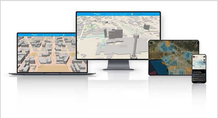
Skyward’s drone airspace map provides a clear design, airspace data, and LAANC access, now combined with essential ground intelligence including 3D views of key structures, transmission lines, and more than a million vertical obstacles. Drone pilots in the field need to know how the surrounding area, including infrastructure, could affect flight, and Skyward offers this critical safety data to all users.
In addition to comprehensive airspace information, the following data is now available for situational awareness: Vertical structure obstacles (over one million structures identified from the FAA and FCC databases), Major power transmission lines, Airports, Pedestrian walking paths and etc.
Skyward Airspace Intelligence is part of the complete workflow that enables pilots to mitigate weather, environment, and business-specific risks.
Mariah Scott, President of Skyward
Skyward Airspace Intelligence is the only solution that provides easy-to-understand data for things like transmission lines, runways, over a million vertical obstacles, and a 3D view of key structures. It’s the next best thing to physically being in the field.


